Chaotic Weather of Santa Cruz by Robert Gallagher in collaboration with Nicolas Tracewell
Download link for Project Model in NetLogo
Download link for Written Report of Project
 This is our Dynamical System Model showing how temperature, pressure, and precipitation of Santa Cruz (top right), Monterey (bottom right), San Jose (bottom left), and Salinas (top left) are all interconnected with flows going to and from each city's temperature along with precipitation and pressure being connected to the flows running between each city. To make more sense of a single flow I will describe the flow from San Jose Temperature to Santa Cruz Temperature: the expression used to describe the flow from San Jose to Santa Cruz takes into account (by "linking" with thin black lined arrows) the temperature, pressure, and precipitation of San Jose all connecting to the flow (thick grey arrow) that leads into Santa Cruz. There is another flow that runs in the opposite direction (Santa Cruz -> San Jose) that has links from Santa Cruz's temperature, pressure, and precipitation. The same holds true for the indvidual flows connecting each city to the other cities.
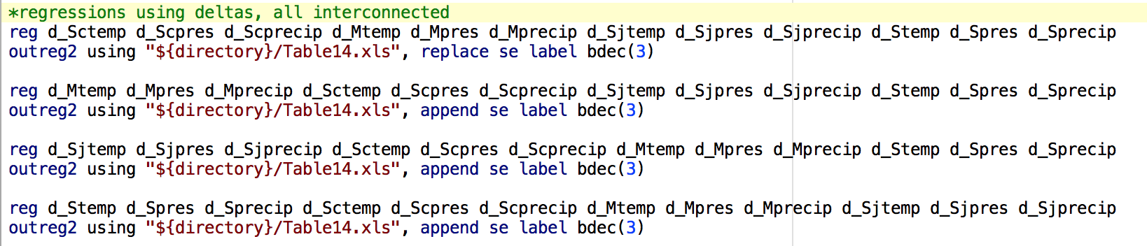 This is a screenshot of the code from Stata used to create the regression tables as shown below in another screnshot.
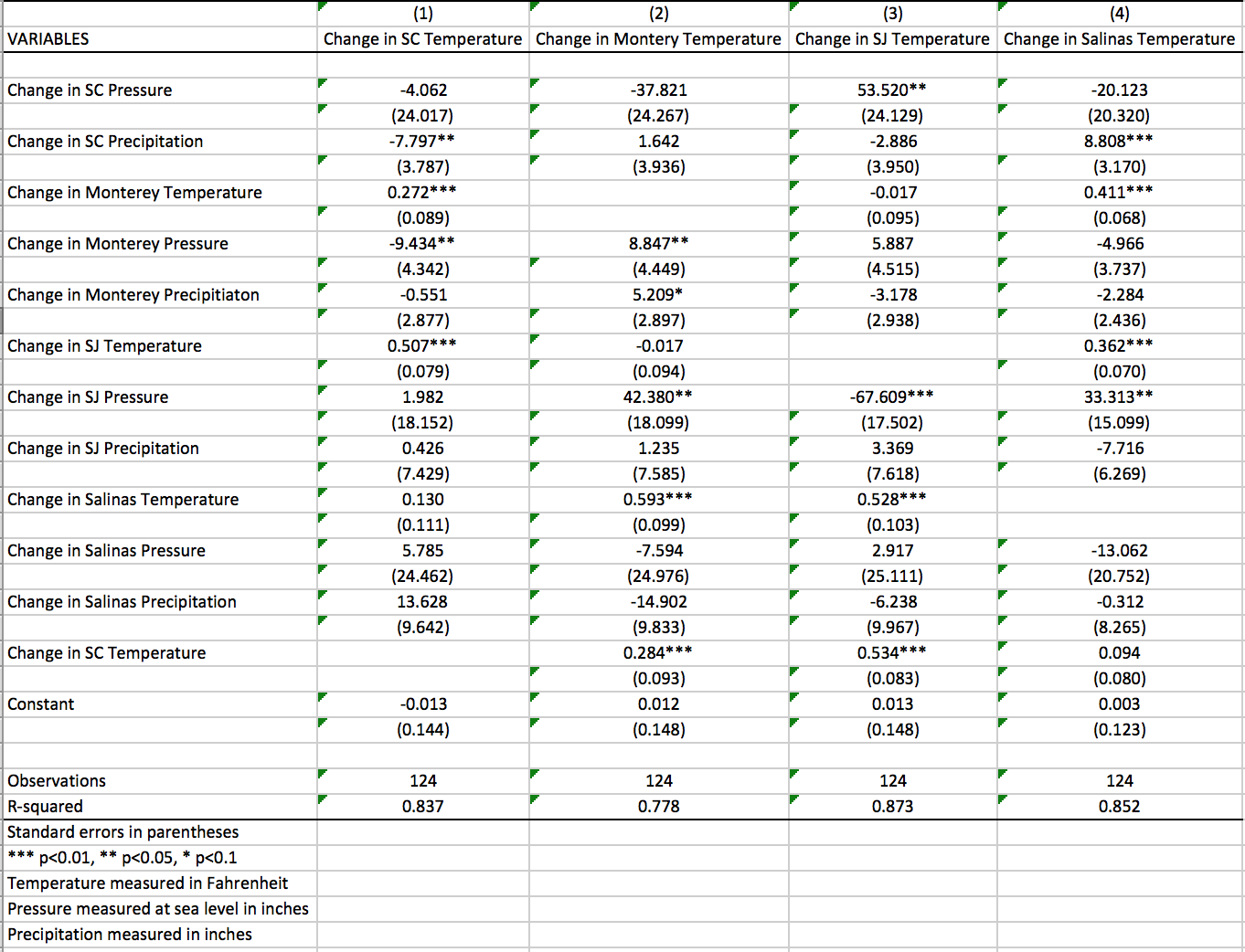 This is the regressions output of the program used called Stata. It shows the ordinary least squares regressions of the outcome variables on the top row and the determinants along the first column with their corresponding coefficients in the table. This table tells the story of which variables are more determinant of a certain city's change in temperature.
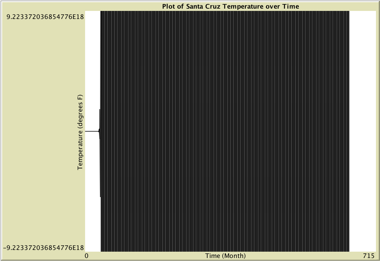
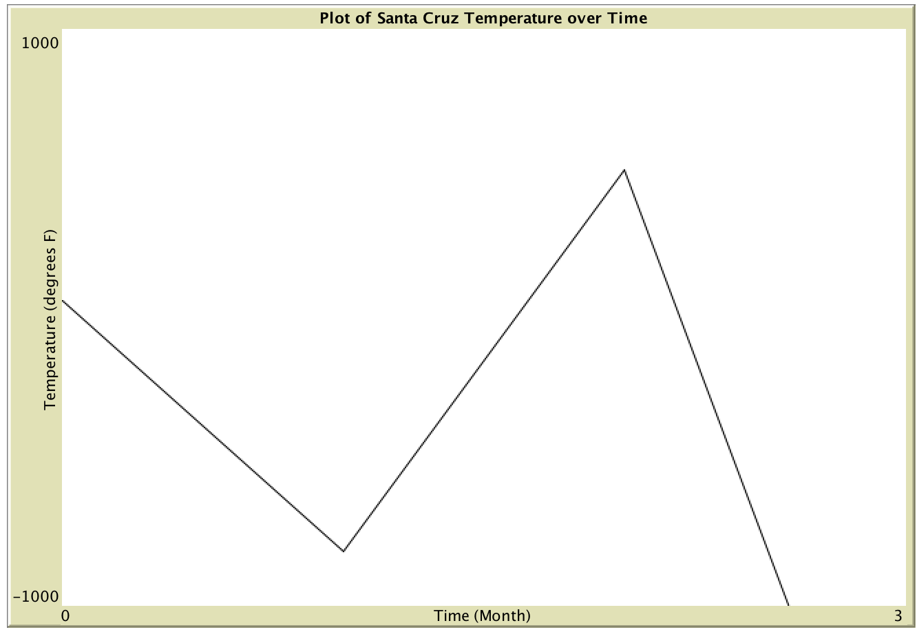 These are graphs of the model from above with flows as shown in the NetLogo Dynamical System Model, iterated numerous times. The grand scheme of the model (as t goes to infinity) shows almost immediate bifurcations with the temperature plummeting to subzero temperatures and skyrocketing well above liveable temperatures in less than a single day. This is representative of the fact that it is quite difficult to accurately predict the weather any further than a couple days given that the model is accurate and minimizes error.